
Additional Information
: Complete License, Single seat
*Please contact us for multi-seat licensing
: Yes
: AI,JPEG,EPS,PDF
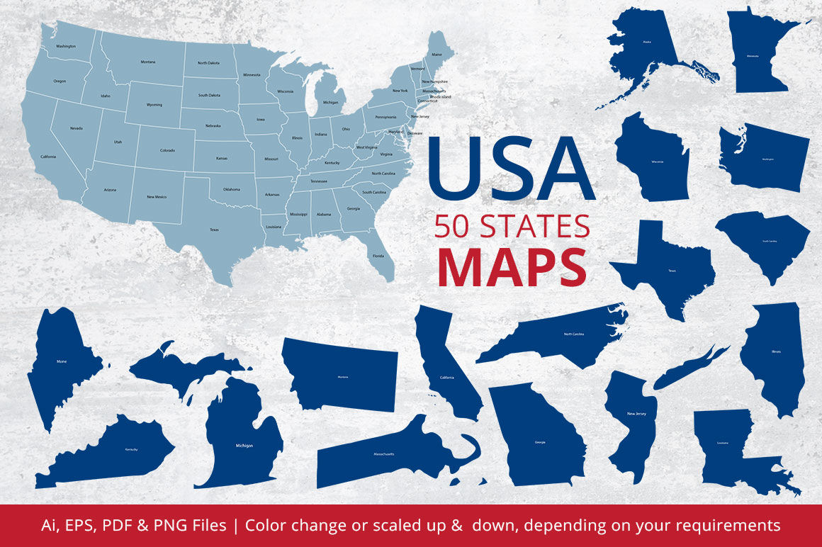
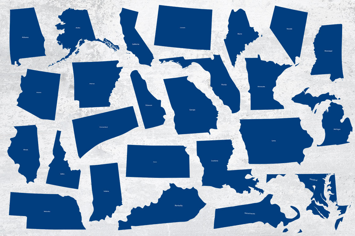
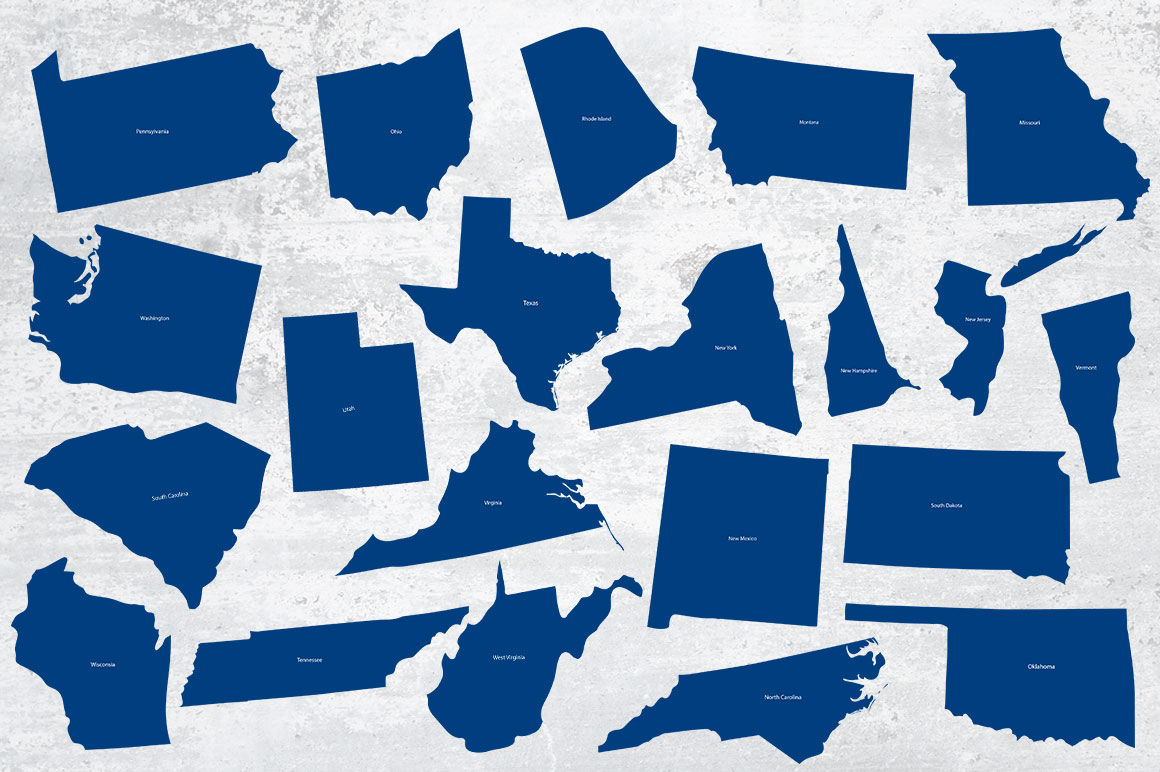
This is a pack containing 50 USA states Maps & USA Map for your websites, applications or other any project. All maps are made of 100% vector shapes, so they can easily be color change or scaled up & down, depending on your requirements. The folder & files is very well organised, with file named appropriately. I hope you appreciate the fresher and cleaner look of the new maps pack.
Featured:
50 states maps + USA map
Ai, EPS & PDF Files
PNG Files
Vector (Re-sizable)
Included Instructions Files
---------------------------------------------------------------------------------------------------------------------------------------------------------------------------------
United States of America (USA), Alabama, Alaska, Arizona, Arkansas, California, Colorado, Connecticut, Delaware, Florida, Georgia, Hawaii, Idaho, Illinois, Indiana, Iowa, Kansas, Kentucky, Louisiana, Maine, Maryland, Massachusetts, Michigan, Minnesota, Mississippi, Missouri, Montana, Nebraska, Nevada, New Hampshire, New Jersey, New Mexico, New York, North Carolina, North Dakota, Ohio, Oklahoma, Oregon, Pennsylvania, Rhode Island, South Carolina, South Dakota, Tennessee, Texas, Utah, Vermont, Virginia, Washington, West Virginia, Wisconsin, Wyoming
Additional Information
: Complete License, Single seat
*Please contact us for multi-seat licensing
: Yes
: AI,JPEG,EPS,PDF
Top selling bundles

Citrus Galore Bundle
$4.00
Other products you may like
Explore our other popular graphic design and craft resources.
0

0


0

0

0

0

0