
Additional Information
: Complete License, Single seat
*Please contact us for multi-seat licensing
: Yes
: AI,PSD,JPEG,PNG,EPS,PPT
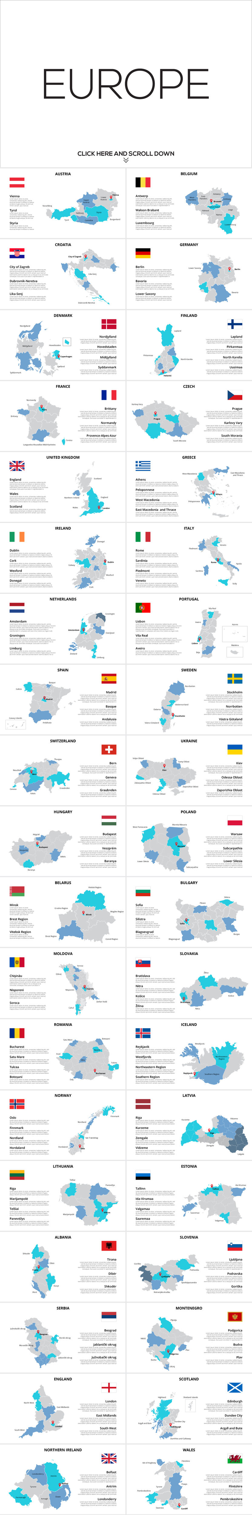
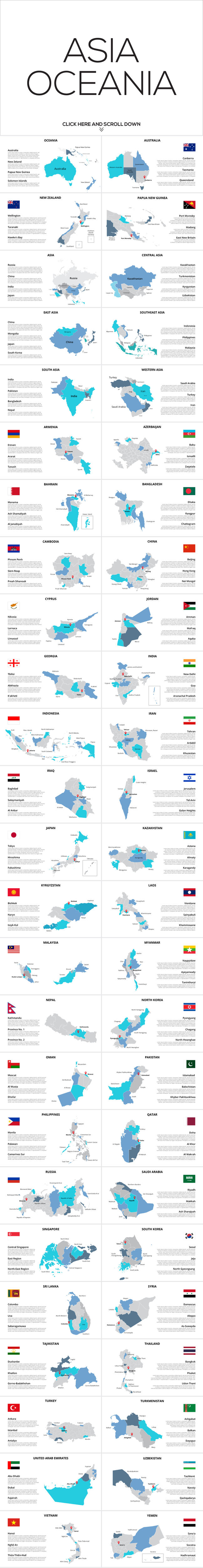
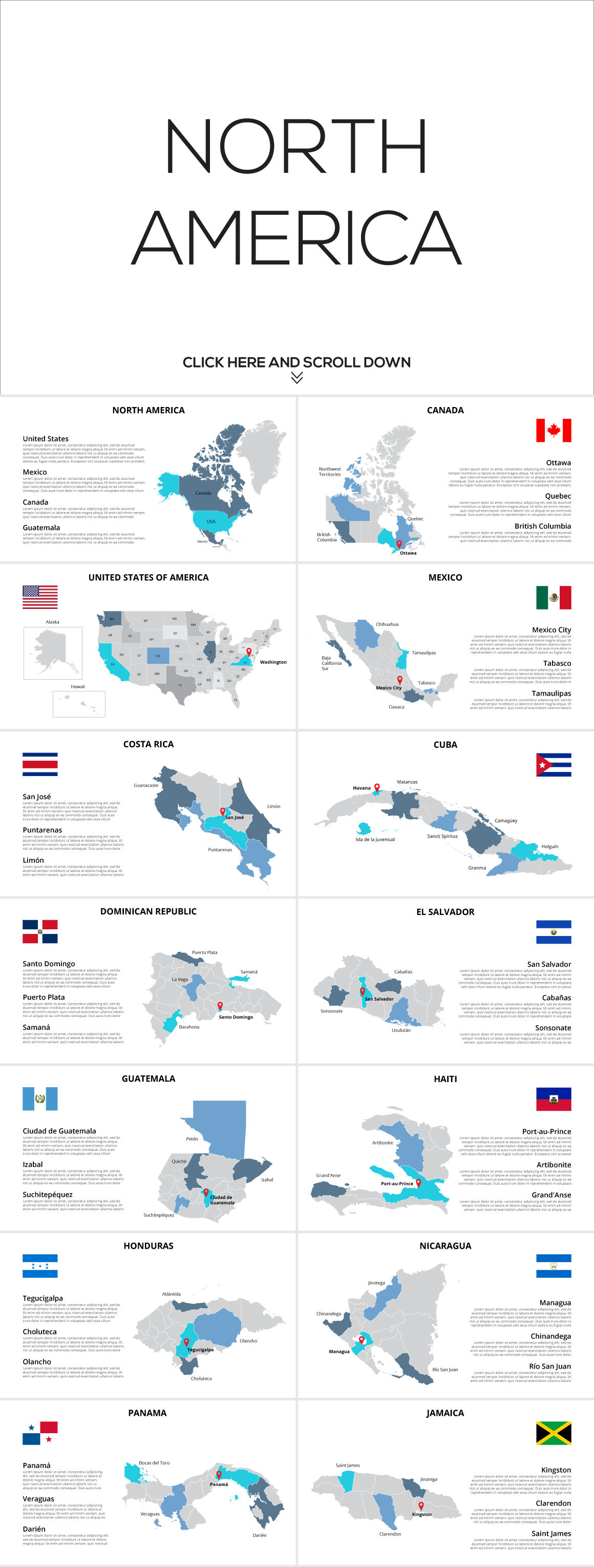
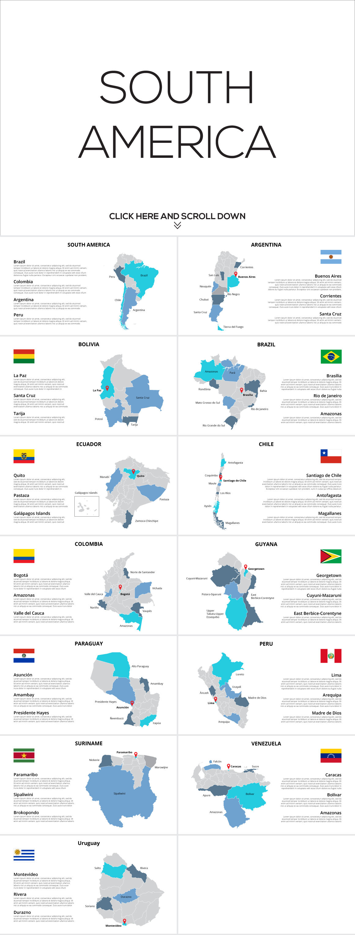
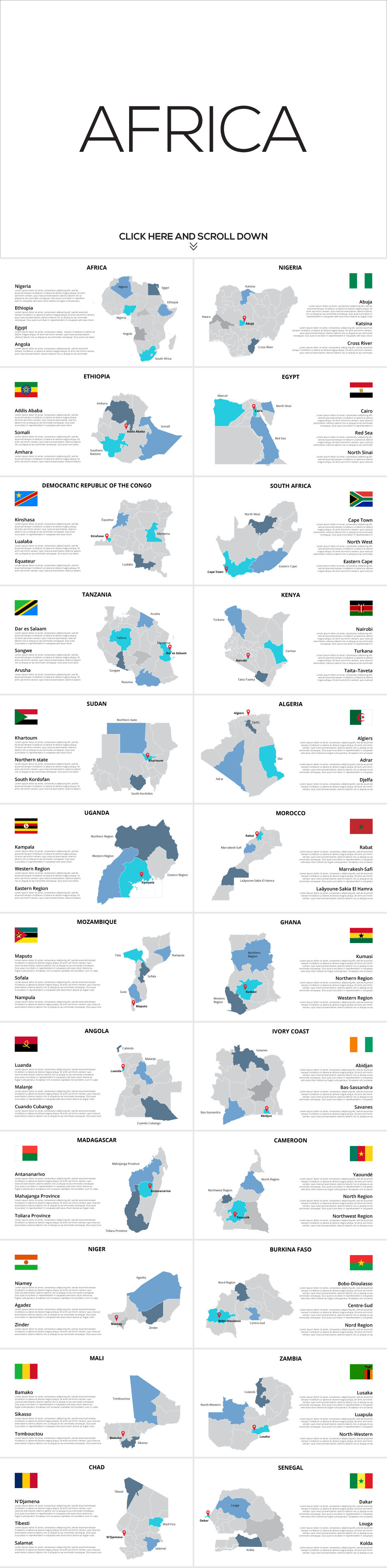
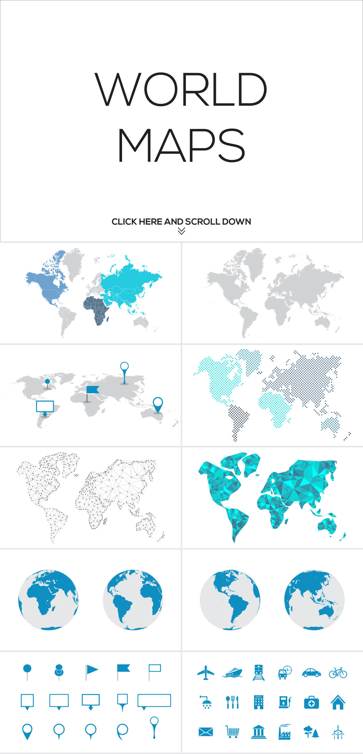
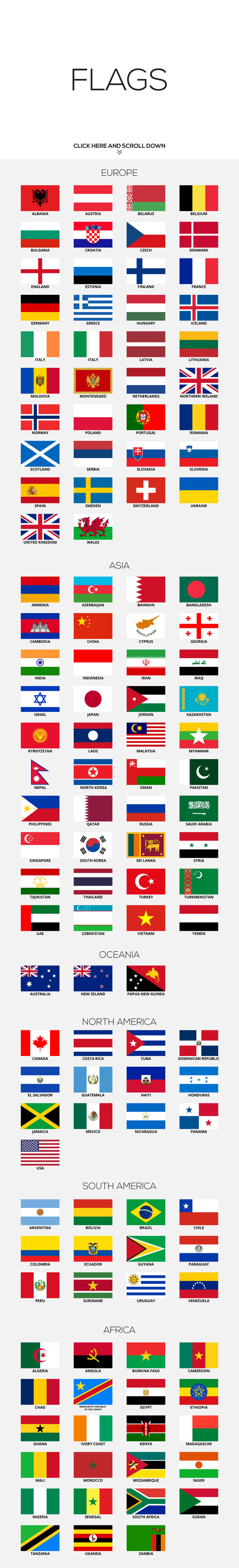
This bundle contains high quality vector maps of 130 countries. Each country is divided into states (regions, provinces, etc.). Also contains vector flags, map markers and navigation icons.
For editing you can use Adobe Illustrator, Adobe Photoshop or Microsoft PowerPoint. Also each infographic is presented in PNG format with a transparent background, with no text or icons.
MAIN FEATURES:
- Fully compatible with Microsoft PowerPoint
- All Objects are PowerPoint Vector Shapes
- Editable text
- All objects are layered, grouped and easily editable
- 100% Vector
Fonts used are all FREE:
- Open Sans
Additional Information
: Complete License, Single seat
*Please contact us for multi-seat licensing
: Yes
: AI,PSD,JPEG,PNG,EPS,PPT
Top selling bundles

Citrus Galore Bundle
$4.00
Other products you may like
Explore our other popular graphic design and craft resources.
0

0


0

0

0
0