
Additional Information
: Complete License, Single seat
*Please contact us for multi-seat licensing
: Yes
: AI,EPS,PDF
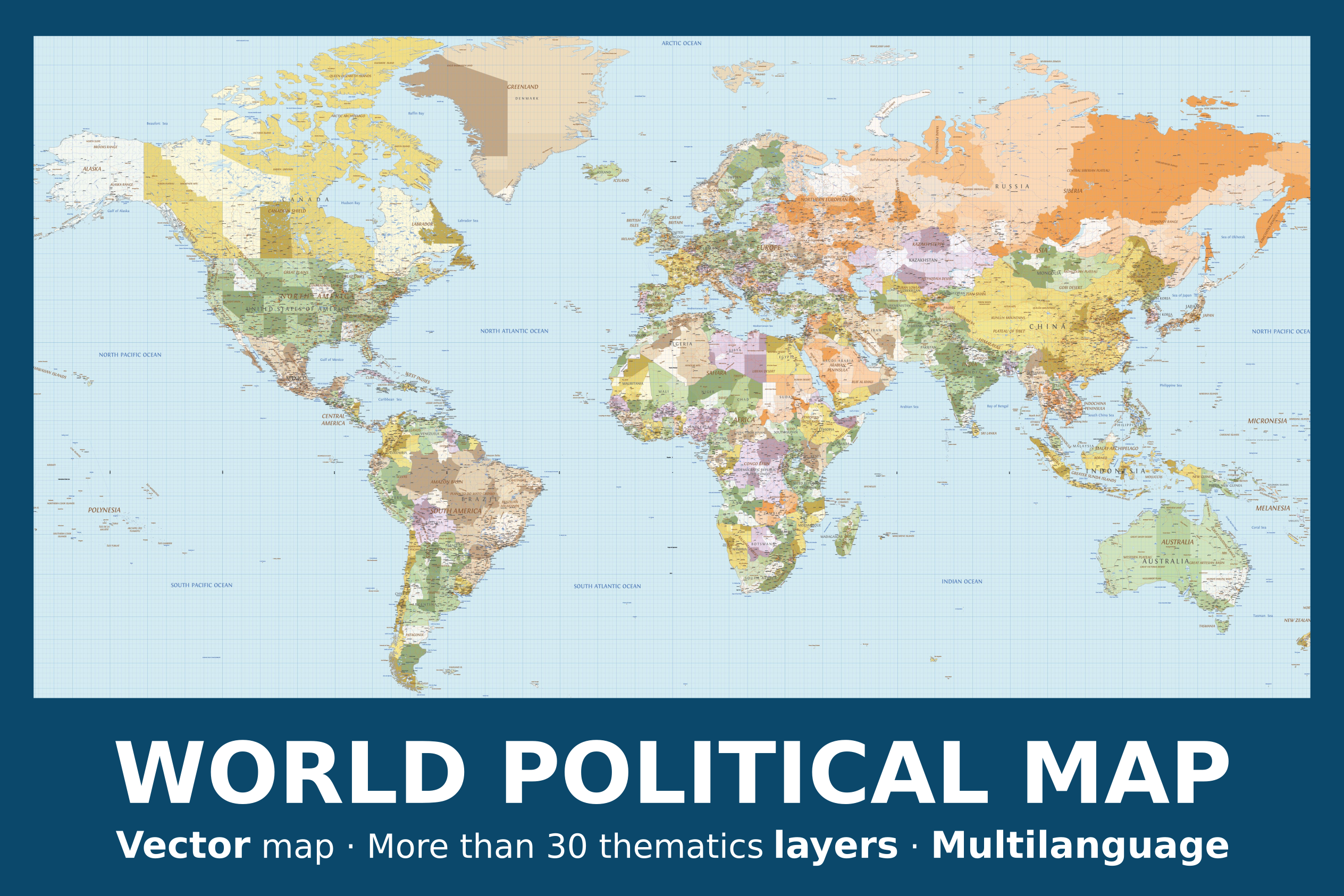
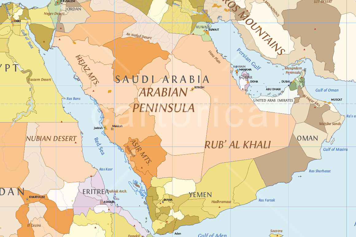
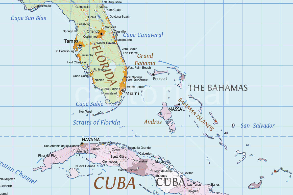
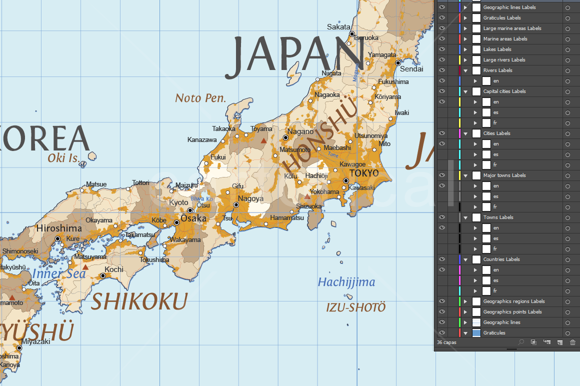
World political map multilayered and scalable to whatever size you want without losing the quality. Ideal for illustrations, prints and multimedia projects.
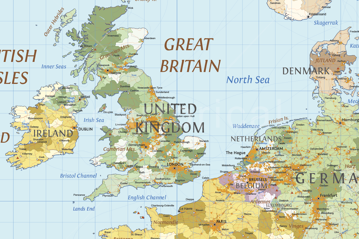
Detailed vector map of every country in the world with subdivisions of areas/territories/jurisdictions recognized by governments or other organizations for administrative purposes. These range from large groups of nation states right down to subnational borders (regions, provinces or states).
Fully editable with multiple thematic layers: Maritime routes, Land, Minor islands, Antarctic ices, Glaciated areas, Countries (translated into three languages), Internal administrative boundaries, Urban areas, Major urban areas, Large urban areas, Reefs, Rivers of Europe, Rivers of North America, Rivers, Large rivers, Lakes of Europe, Lakes of North America, Lakes, Elevation points, Railroads, Roads, Towns (translated into three languages), Major towns (translated into three languages), Cities (translated into three languages) and Graticule layers.
The design respect the rules and standards of cartographic composition with a style of colors and patterns consistent and creative. Adjacent polygons have not the same color, which helps the reader understand the map.
All texts can be modified: real text, no outlines. The typographies utilized are appropriate for use in mapping, maintaining readability in small spaces and on complex backgrounds of the map. It also utilize a hierarchical correct use of font size. All them are free for personal and commercial use.
About 130,000 vector elements distributed in 47 thematic layers.
1600 editable labels with place names in real text.
Real text layered.
Typeface commensurate with the mapping recommendations: Three fonts with open licenses included.
Color schemes adapted to the theory of color in cartography and based in the 4colors theorem.
Languages: English, Spanish and French.
Projection: Miller cylindrical.
Original scale: 1:10,000,000
Dimensions: About 93.6 x 66.2 in (238 x 168 cm) scalable.
Format file: Adobe Illustrator (.ai), pdf, eps
Free regular updates.
Notes:
Suitable for use up to any size but If using the whole map it is not suitable for under A0 due to the amount of detail. Useful to be able to crop any area/region of the world or when you just need a very large high quality map.
This map can be combined with Cartorical Topographic World Map and Cartorical Marine World Vector Map.
If you need a map of Europe, North America o Asia with more detail we suggest our Regional Political Maps.
You can see these products in our shop.
Additional Information
: Complete License, Single seat
*Please contact us for multi-seat licensing
: Yes
: AI,EPS,PDF
Top selling bundles

Citrus Galore Bundle
$4.00
Other products you may like
Explore our other popular graphic design and craft resources.
0
0

0


0

0

0