

Additional Information
: Complete License, Single seat
*Please contact us for multi-seat licensing
: AI,PDF
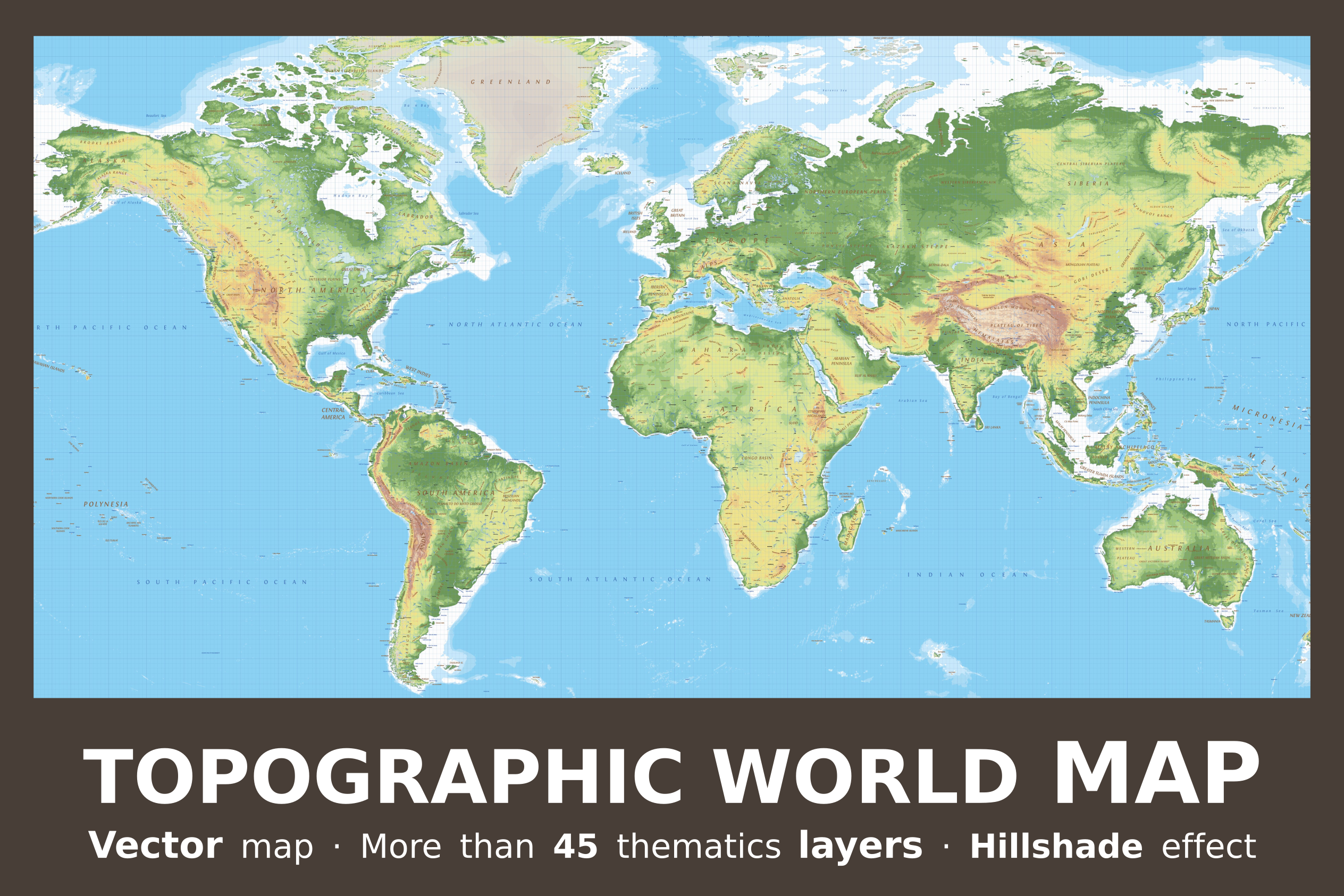
World physical map multilayered and scalable to whatever size you want without losing the quality. Colorized by altitude, ideal for illustrations and prints.
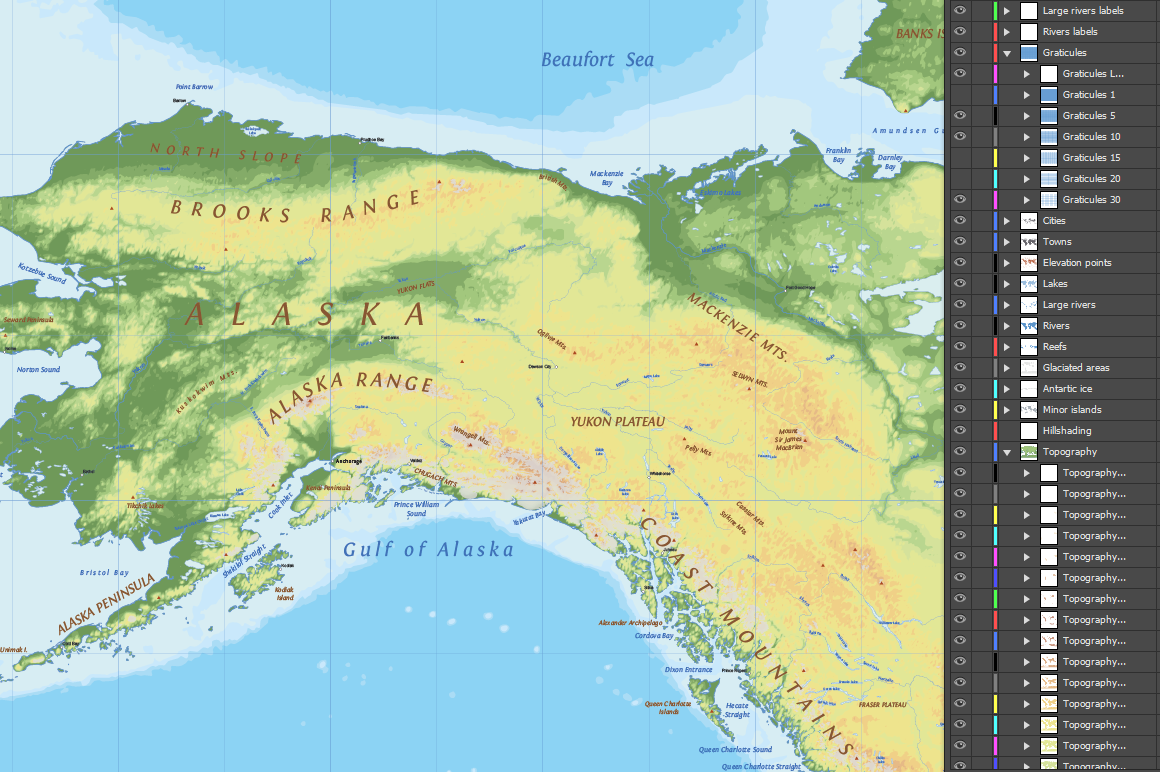
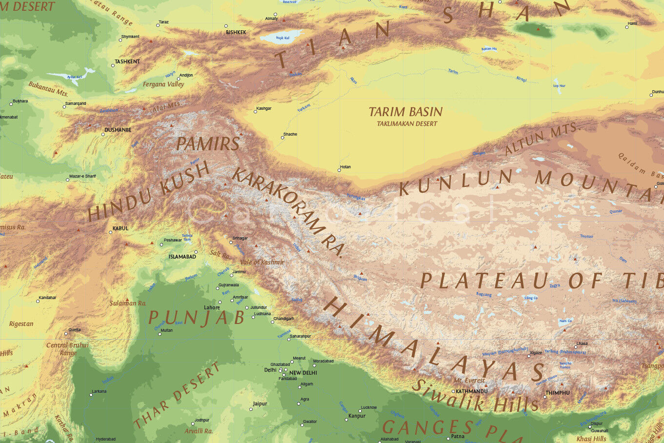
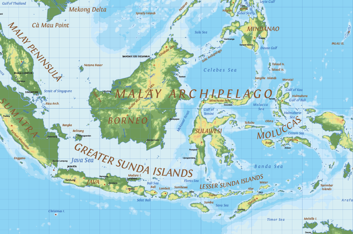
Editable vector map of the whole world in a relief design. Provides physical details, land elevations, minor islands, rivers, natural and artificial lakes and others features type. The map is fully vector, including elevation ranges represented by hypsometric tints.
Elevation contours with 500 meters interval (the first 500 meters for every 100 meters). The selected palette have color gradient adapted for topography.
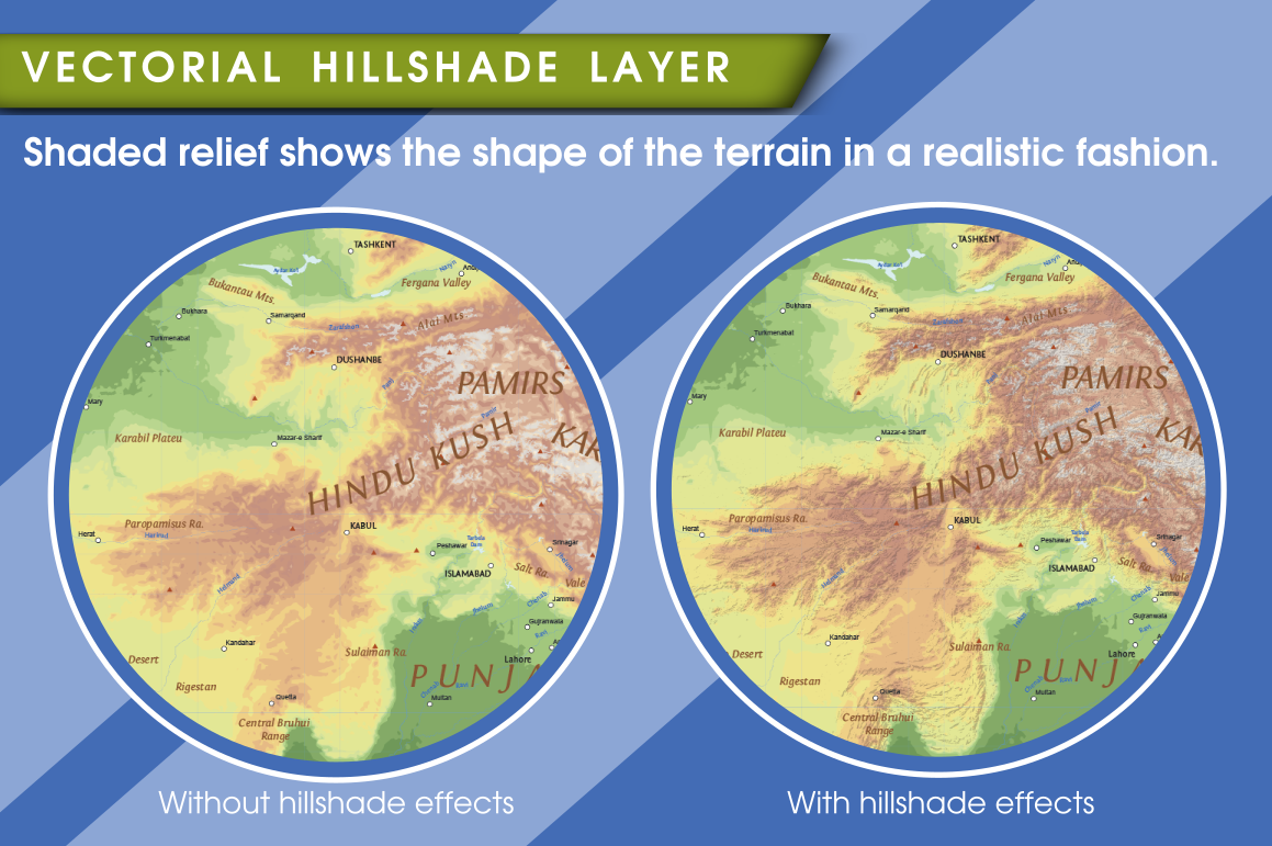
The map has a vector layer (no bitmap) that produces a hillshade effect highlighting the relief. Shaded relief shows the shape of the terrain in a realistic fashion by showing how the threedimensional surface would be illuminated from a point light source.
It contains the major physical features of the planet with their labels. Texts placed manually depending on the orientation of the elements.
All texts can be modified: are texts, no outlines. The typographies utilized are appropriate for use in mapping, maintaining readability in small spaces and on complex backgrounds of the map. It also uses a hierarchical correct use of font size. All them are free for personal and commercial use.
More than 102,000 vector elements distributed in 46 thematic layers: Elevation contours layers, Shade relief, Minor islands, Antartic ices, Glacited areas, Reefs, Rivers, Large rivers, Lakes, Elevation points, Towns, Cities and Graticule layers.
4,500 editable labels with place names in real text.
Dimensions: About 93.6 x 66.2 in (238 x 168 cm) scalable.
Real text layered.
Typeface commensurate with the mapping recommendations: Three fonts with open licenses included.
Color schemes adapted to the theory of color in cartography.
The language on this map is English.
Contour line: Elevation contour lines (isohypses) with 500 meters interval (the first 500 meters for every 100 meters). Depth contours (isobaths) in 200, 1,000 and 2,000 meters.
Projection: Miller cylindrical.
Original scale: 1:10,000,000
Format file: Adobe Illustrator (.ai) and PDF
Free regular updates.
Notes:
This map can be combined with Political World Vector Map and Marine World Vector Map. You can see these products in our shop.
If you need a more detailed map you can take a look at our regional maps.
Additional Information
: Complete License, Single seat
*Please contact us for multi-seat licensing
: AI,PDF
Top selling bundles

Citrus Galore Bundle
$4.00
Other products you may like
Explore our other popular graphic design and craft resources.
0
0

0

0
0
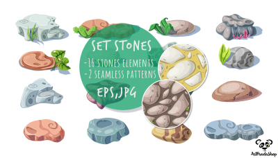
set stones nature rocks, boulders. Vector object and seamless patterns
by ArtPandaShop
$4.00 $5.00
-20%