
Additional Information
: Complete License, Single seat
*Please contact us for multi-seat licensing
: 46 cm x 46 cm
: AI,EPS,PDF
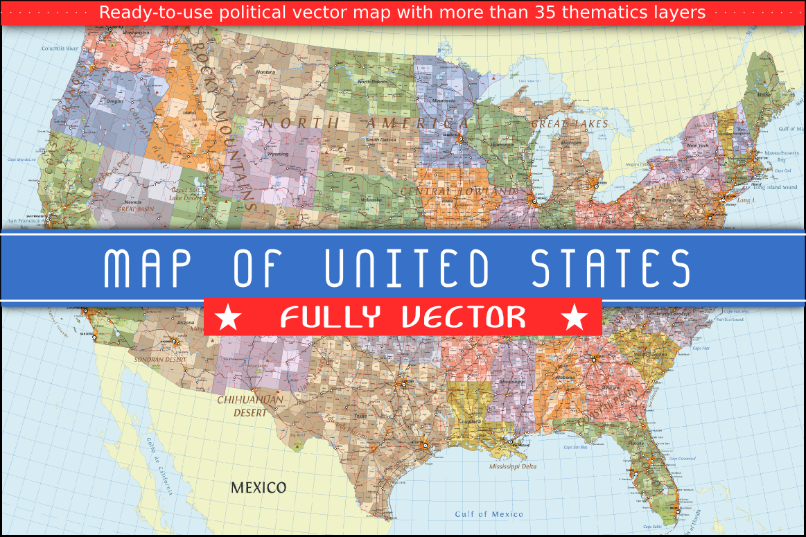
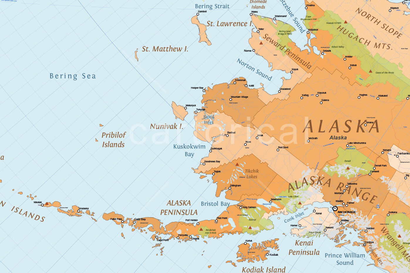
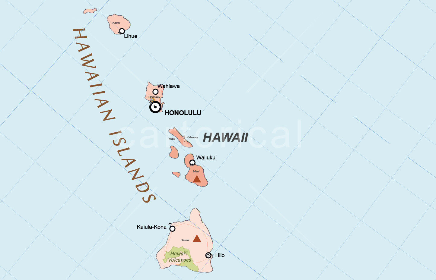
Political vector map of USA multilayered and scalable to whatever size you want without losing the quality. Ideal for illustrations, prints or multimedia projects.
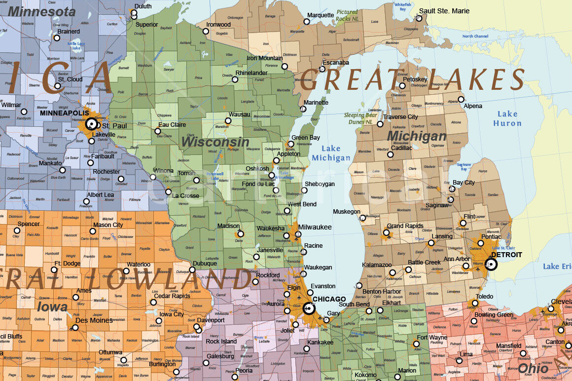
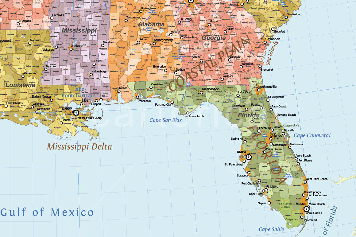
The map contain the three levels in the administrative divisions of the United States of America: states, counties, and cities, towns and villages.
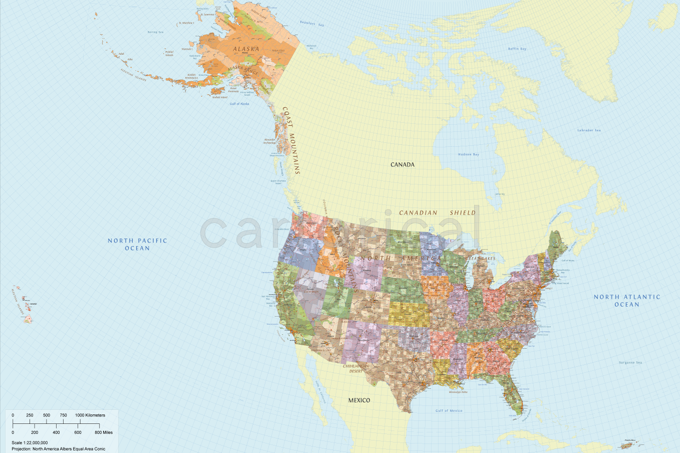
Detailed vector map with all states and counties of the country and another continental and insular organized territories.
Fully editable with multiple thematic layers:
Land
Geographics regions
Marine areas
Parks and protected lands area
Countries
States
Countiesmunicipalities
Urban areas
Major urban areas
Large urban areas
Rivers
Lakes
Elevation points
Railroads
Roads
Towns
Major towns
Cities, Airports
Ports
Geographics lines
Graticule layers
In addition, the map has multiple layers with texts containing the names of states, counties, cities, rivers, lakes, peaks and other geographic features.
The design respect the rules and standards of cartographic composition with a style of colors and patterns consistent and creative. Adjacent polygons have not the same color, which helps the reader understand the map.
All texts can be modified: real text, no outlines. The typographies utilized are appropriate for use in mapping, maintaining readability in small spaces and on complex backgrounds of the map. It also utilize a hierarchical correct use of font size. All them are free for personal and commercial use.
About 160,000 graphics elements and 4,500 editable labels with place names distributed in more than 35 thematic layers and sublayers.
Real text layered.
Typeface commensurate with the mapping recommendations: Three fonts with open licenses included.
Color schemes adapted to the theory of color in cartography and based in the 4colours theorem.
Language: English.
Projection: North America Albers Equal Area Conic.
Original scale: 1:10,000,000.
Dimensions: About 18×13 in (46×33 cm) scalable.
Format file: Adobe Illustrator (AI), PDF, EPS.
This map can be combined with **Vector Map of Canada**. You can see this product in our store.
Additional Information
: Complete License, Single seat
*Please contact us for multi-seat licensing
: 46 x 33 cm
: AI,EPS,PDF
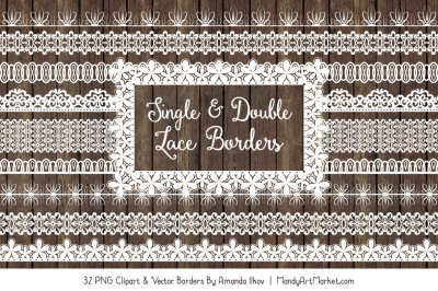
Top selling bundles

Citrus Galore Bundle
$4.00
Other products you may like
Explore our other popular graphic design and craft resources.
0

0
0

0
0

0