

Additional Information
: Complete License, Single seat
*Please contact us for multi-seat licensing
: Yes
: AI,PDF
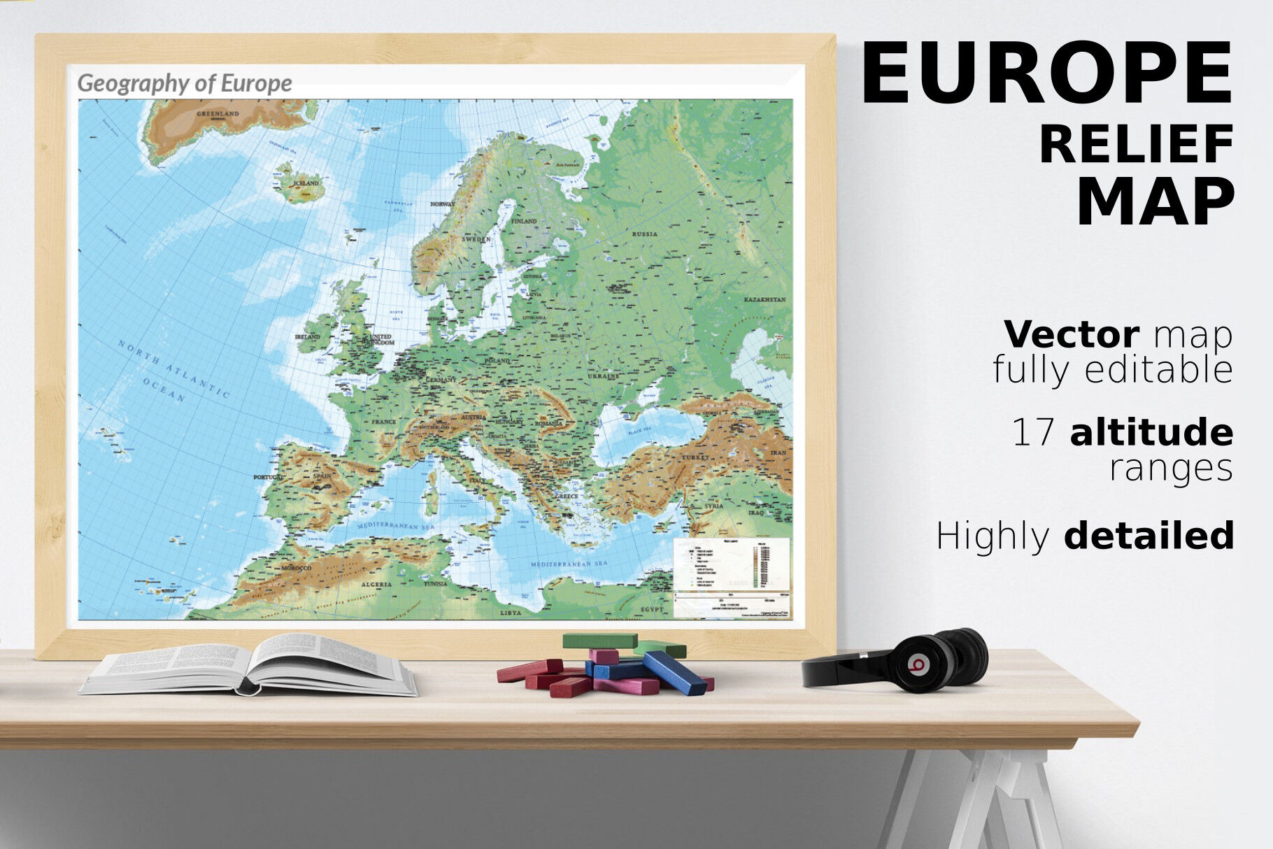
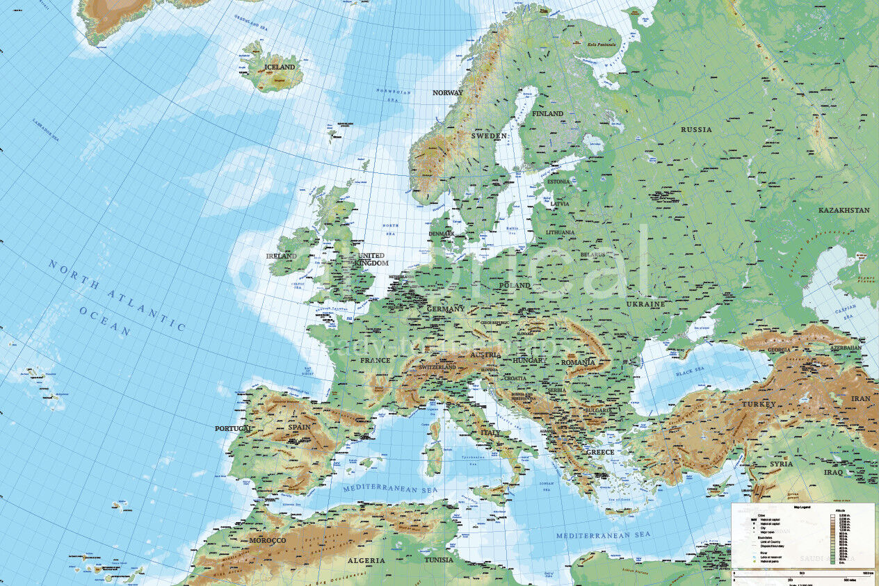
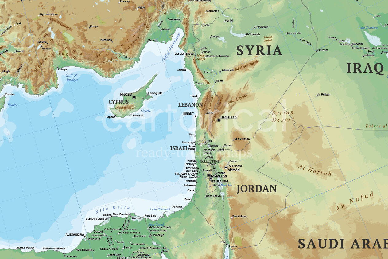
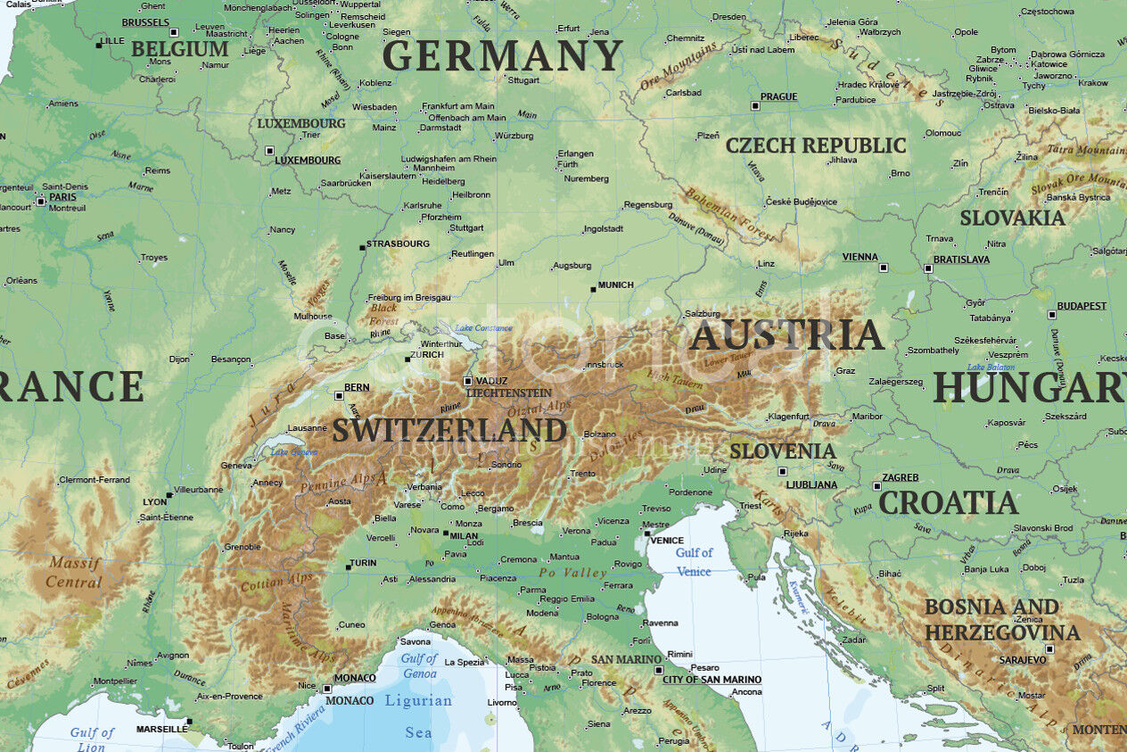
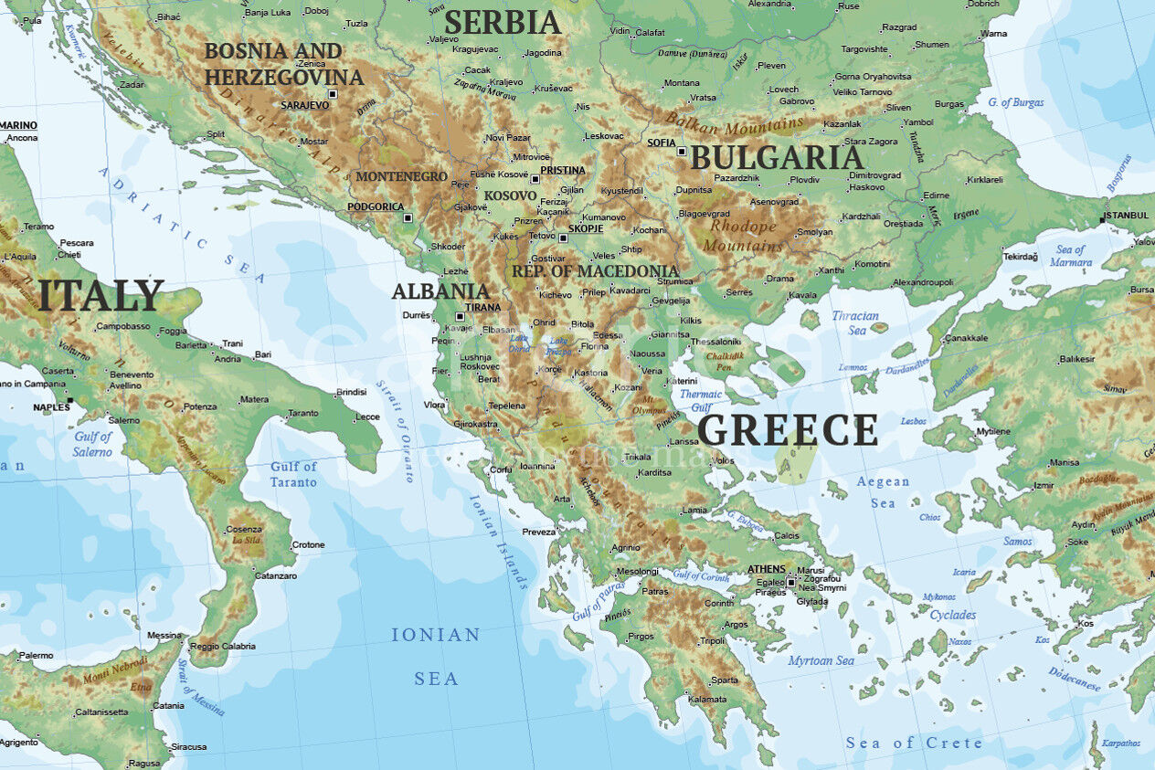
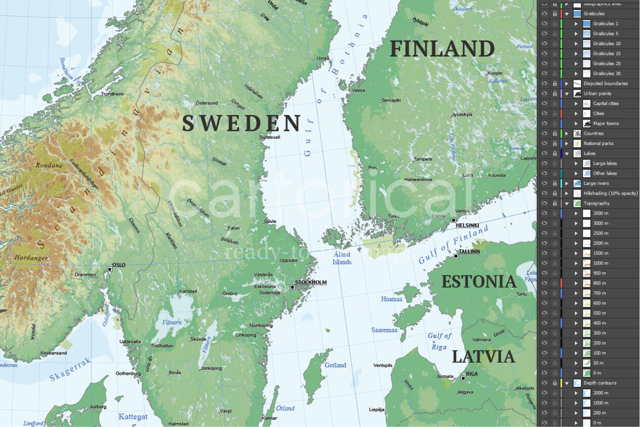
Physical map of Europe, multilayered and scalable to whatever size you want without losing the quality. Colored by altitude, ideal for illustrations, prints or multimedia projects.
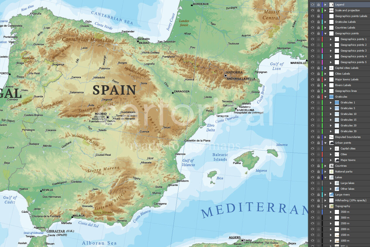
Provides physical details, land elevations, minor islands, rivers, natural and artificial lakes and others features type. The map is fully vector, including shaded relief and elevation ranges represented by hypsometric tints (it are shapes, there's no raster layer).
The color ramp of the elevation polygons on the map is derived from ASTER GDEM data collected by METI and NASA. With elevation contours with 100 meters interval the first 1,000 meters. The selected palette have color gradient adapted for topography.
It contains the major physical features of Europe with their labels. Texts placed manually depending on the orientation of the elements.
All texts can be modified: texts, no outlines. The typographies utilized are appropriate for use in mapping, maintaining readability in small spaces and on complex backgrounds of the map. It also uses a hierarchical correct use of font size. All them are free for personal and commercial use.
With multiple thematic layers:
Depth contours (by intervals).
Elevation contours (by intervals).
Major rivers.
Major and minor lakes.
Physical names (sorted by category).
National parks.
Countries (boundaries).
Disputed boundaries.
Major settlements: Capital cities, cities and town.
Labels for all features.
Graticule with latitude/longitude.
Technical description
More than 1,800 editable labels with place names in real text and manually oriented.
Vector elements distributed in 22 thematic layers with sublayers.
17 elevation contour lines (isohypses) sublayers.
Dimensions: 4A0 (1682 x 2378 mm or 66.2 x 93.6 pulg). Scalable.
Real text layered.
The language on this map is English.
Projection: Lamberts Conic.
Original scale: 1:3,000,000
Format files: Adobe Illustrator (.ai) and PDF
Free regular updates.
Notes
This map can be overlay with Political map of Europe. You can see this products in our shop.
Additional Information
: Complete License, Single seat
*Please contact us for multi-seat licensing
: Yes
: AI,PDF
Top selling bundles

Citrus Galore Bundle
$4.00
Other products you may like
Explore our other popular graphic design and craft resources.

0


0

0

0

0

0